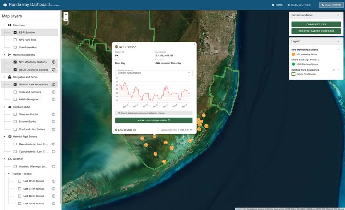
Interactive dashboard integrating real-time and historical hydrologic and water quality monitoring with weather forecasts, benthic habitat layers, and satellite-derived HAB…
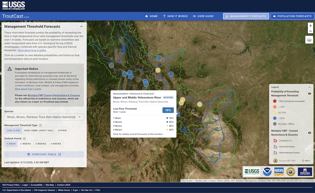
Web-based dashboard showing real-time predictions of low-flow and high-temperature fishery closures and long-term population forecasts of native salmonid species in Montana.
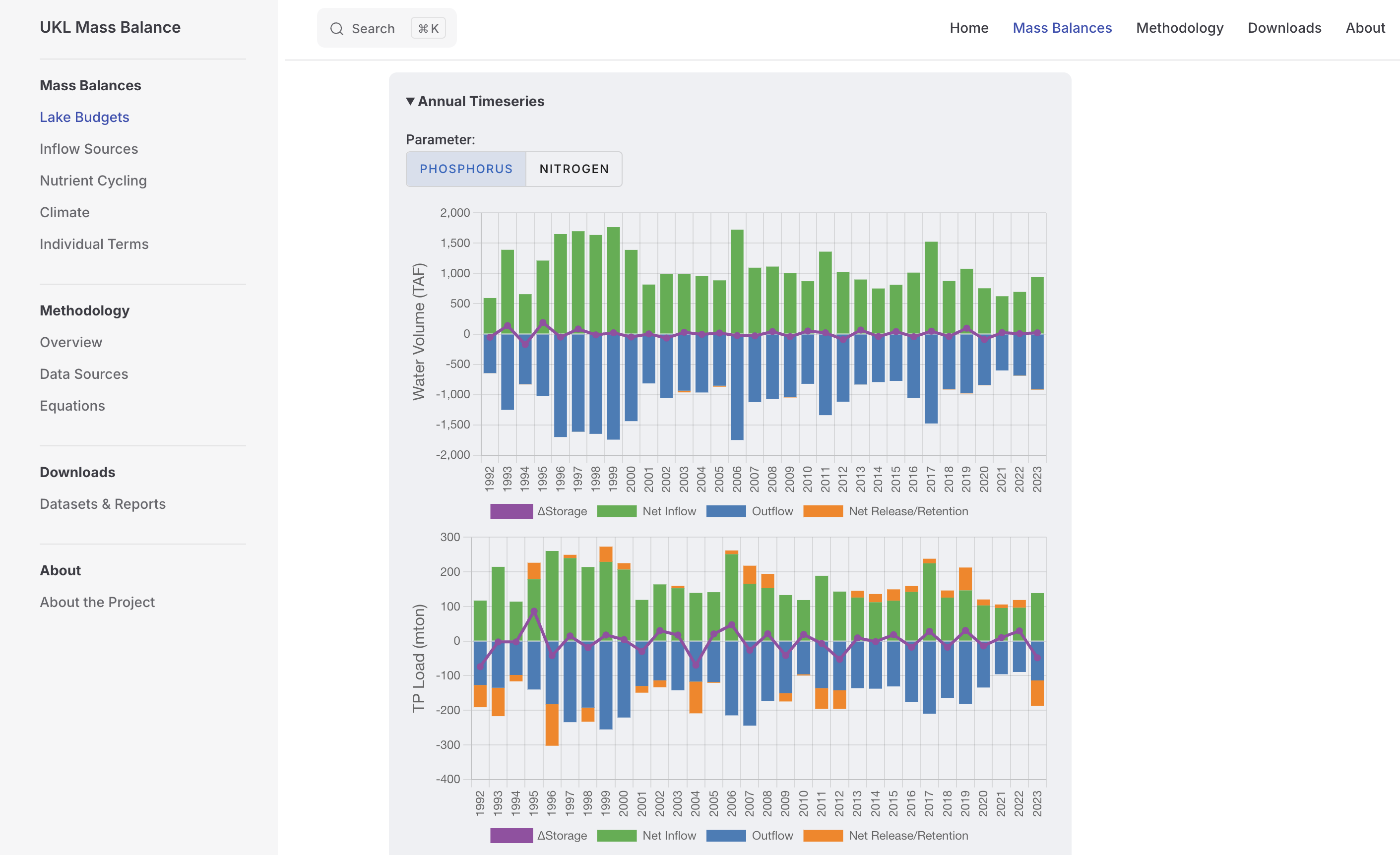
Website for exploring water and nutrient budgets of Upper Klamath Lake
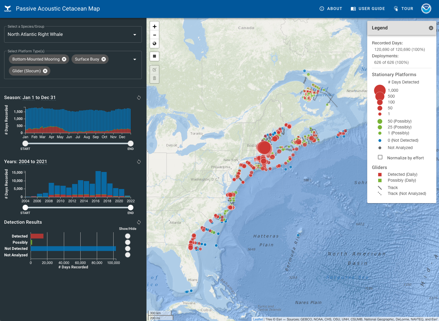
A nationwide website for Passive Acoustics data at NOAA Fisheries.
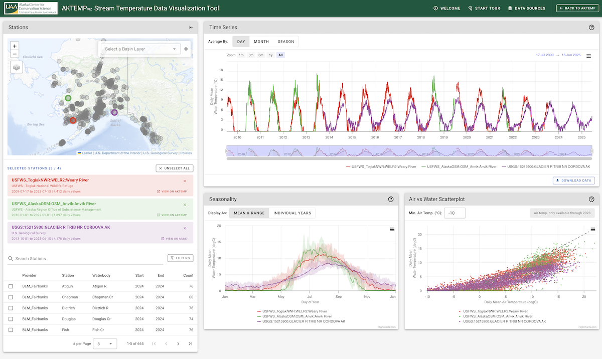
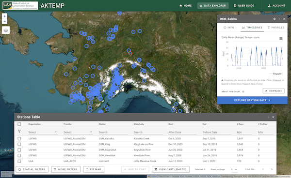
An interactive data visualization of air-water temperature dynamics in streams and rivers across Alaska.
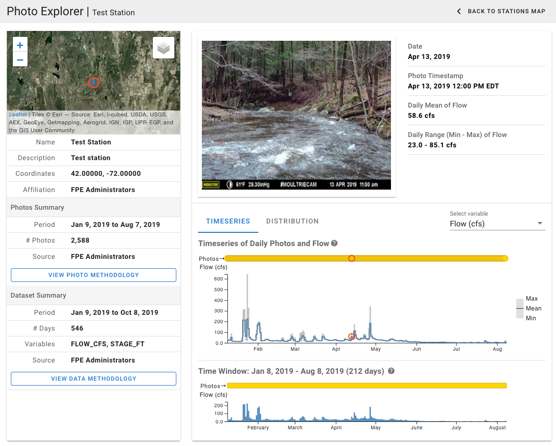
An integrated database, data visualization, and machine learning platform for predicting streamflow from timelapse imagery.
Interactive data visualization tool developed for the NOAA NEFSC Passive Acoustic Branch for exploring detections of whales and other cetaceans using passive acoustic…
A water temperature database for exploring, uploading, managing, and downloading stream and lake temperature data across Alaska.
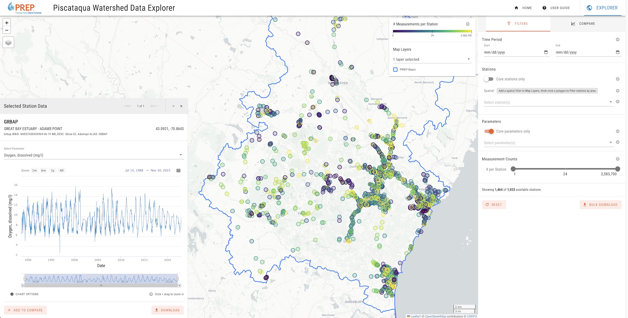
An interactive data explorer for accessing, visualizing, and downloading water quality data in the Piscataqua River watershed.
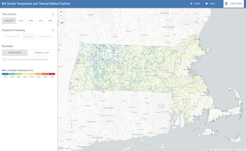
A regional model for predicting climate-driven changes in stream temperature and thermal habitats of gauged and ungauged streams and rivers in Massachusetts based on air…
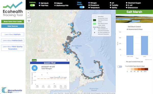
An interactive data visualization tool for exploring habitat and water quality data along Massachusetts coastal embayments.
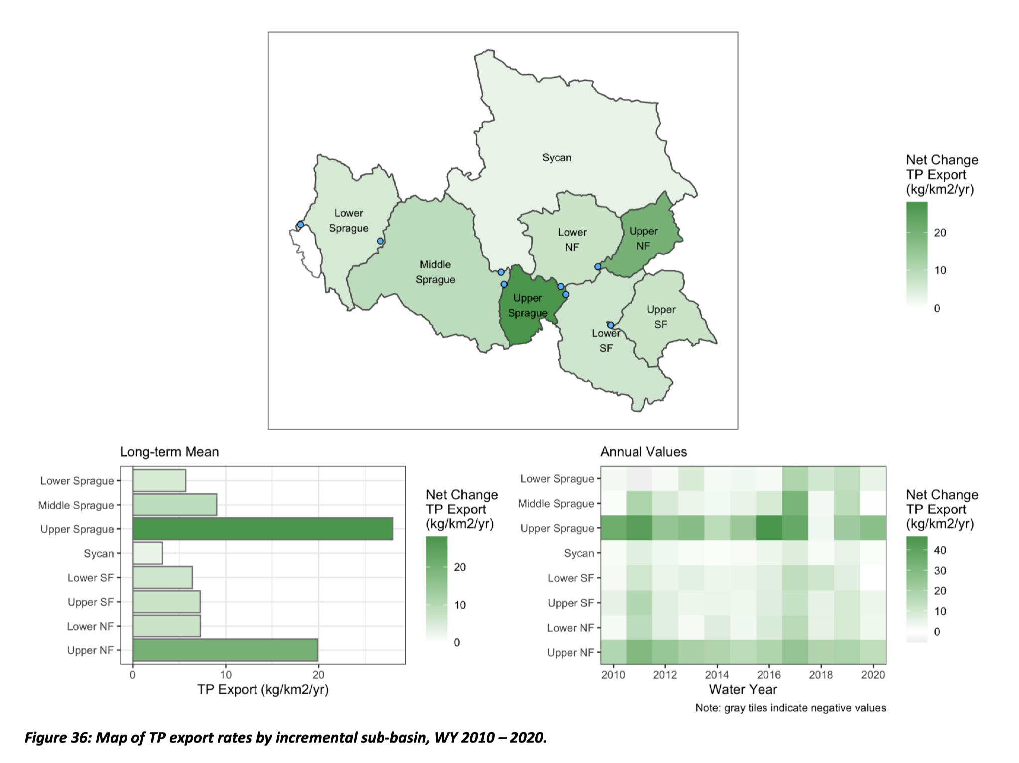
Estimation and trend analysis of spatial and temporal nutrient loading dynamics in the Sprague River basin, OR using long-term monitoring datasets.
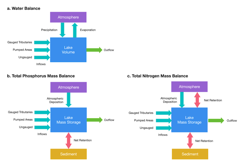
Estimation and trend analysis of watershed loading and in-lake nutrient (P, N) budgets of a shallow, hyper-eutrophic lake using long-term monitoring datasets.
A collection of databases, models, and data visualization tools designed to improve our understanding of stream ecosystems.
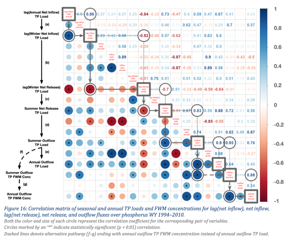
An exploratory data analysis of phosphorus loading dynamics in a shallow, hyper-eutrophic lake to evaluate whether recent inflow loads are closely coupled with outflow loads…
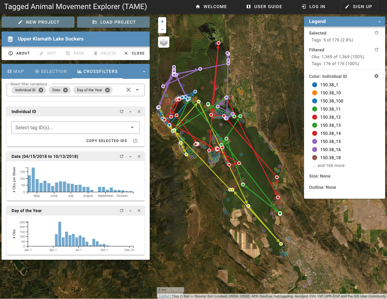
Interactive data visualization tool for exploring spatial and temporal patterns of tagged animal movements.
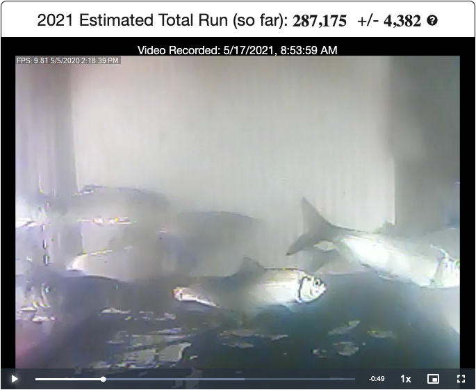
A web-based, citizen science platform to estimate annual herring migrations by collecting fish counts from underwater videos.
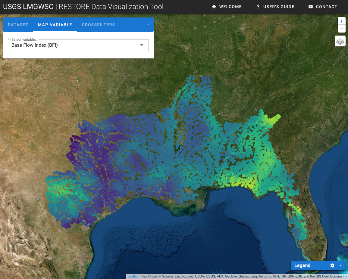
An interactive data visualization tool for exploring streamflow patterns and degrees of alteration in the Lower Mississippi-Gulf region.
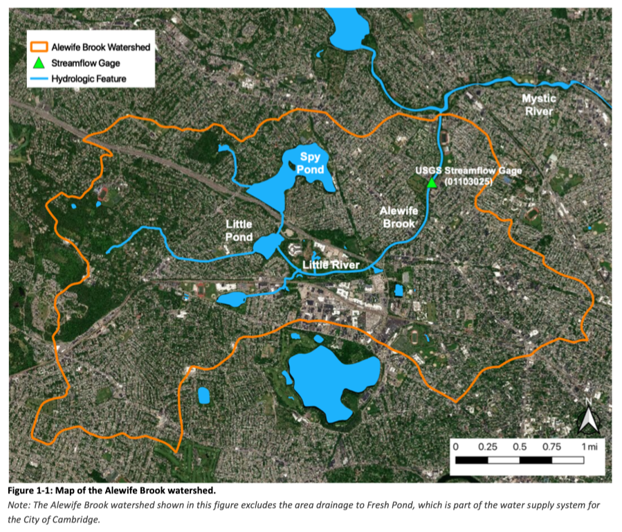
A modeling study to evaluate the feasibility of using a deep kettle pond as a stormwater detention facility to reduce downstream flooding in Alewife Brook.
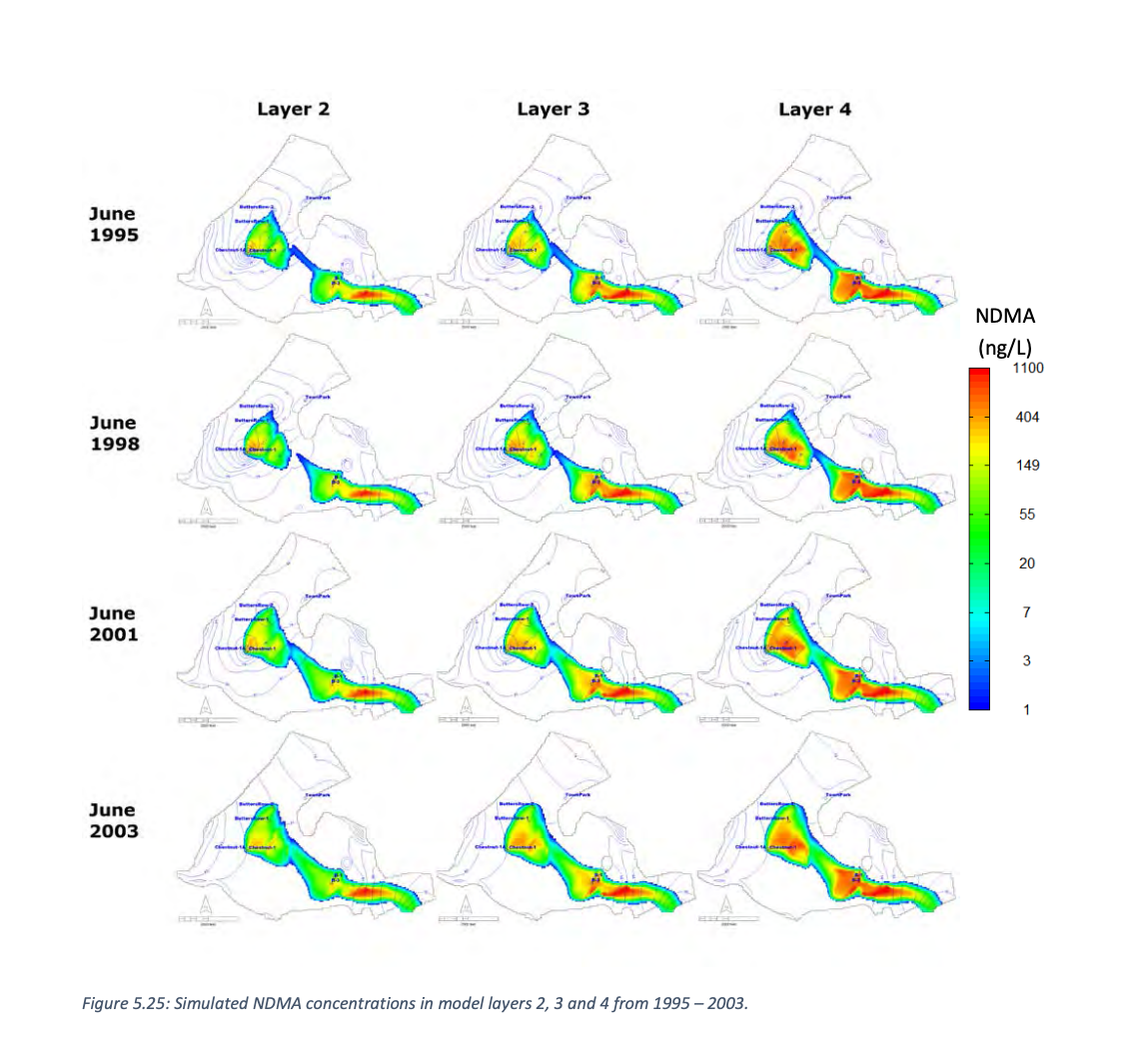
Modeling n-nitrosodimethylamine and trichloroethylene concentrations in the Wilmington, Massachusetts, water supply system - 1974 to 2000.
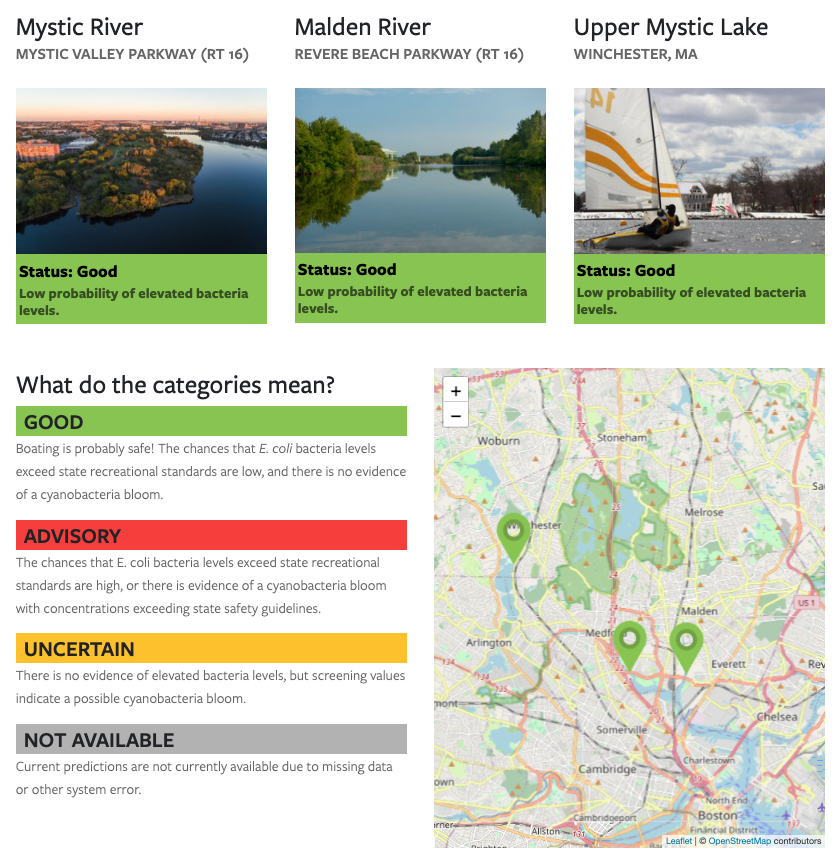
A real-time water quality alert system for notifying the public of unsafe bacteria levels in the Mystic River watershed.
A collection of interactive data visualization tools of hydrologic and water quality models.